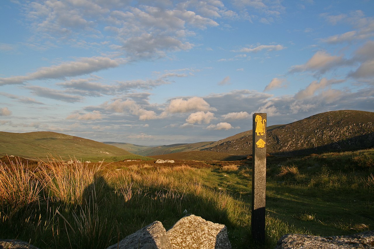
The Saint Kevin's Way
The Saint Kevin's Way: is a pilgrim path in County Wicklow, Ireland. It is 30 kilometres (19 miles) long and begins in the village of Hollywood, crosses the Wicklow Gap, and ends at the remains of the medieval monastery in Glendalough. An alternative spur route begins at Valleymount and joins the main trail at Ballinagee Bridge. It is typically completed in one day. A path of Christian pilgrimage since the route’s namesake travelled along it to reach a life of solitude and prayer in the late 6th/early 7th century, Saint Kevin’s Way has remained a popular trail among the spiritual as well as the secular ever since.
- Type: Linear trail
- Grade: Moderate trail
- Length:30km
- Estimated time: 1 day
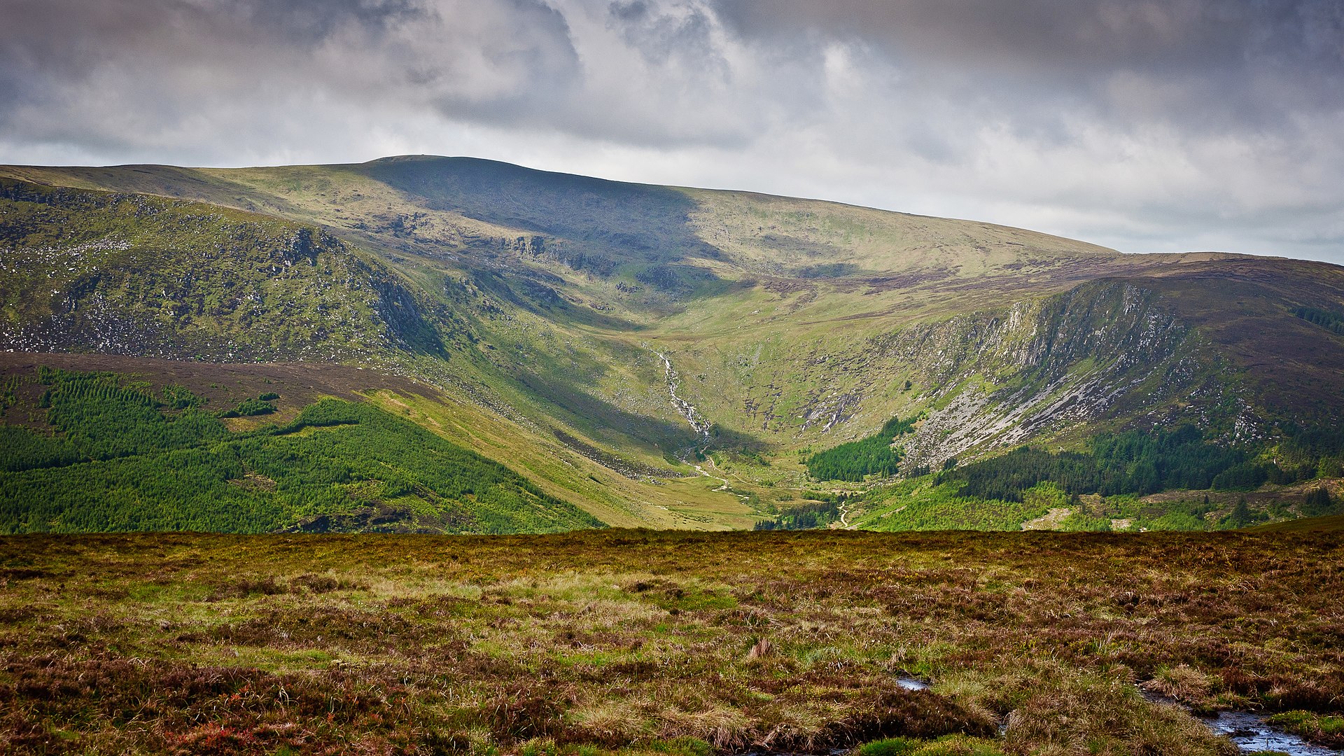
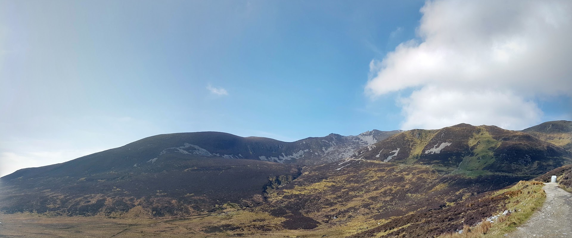
Lugnaquilla
Lugnaquilla, at 925 metres (3,035 ft), is the 11th–highest peak in Ireland on the Arderin list, and 13th–highest on the Vandeleur-Lynam list, and the highest Irish mountain outside of Kerry. Lugnaquilla is the highest point in Wicklow, and in the province of Leinster. Lugnaquilla is in the Wicklow Mountains, and overlooks the Glen of Imaal to the west and Glenmalure to the east.
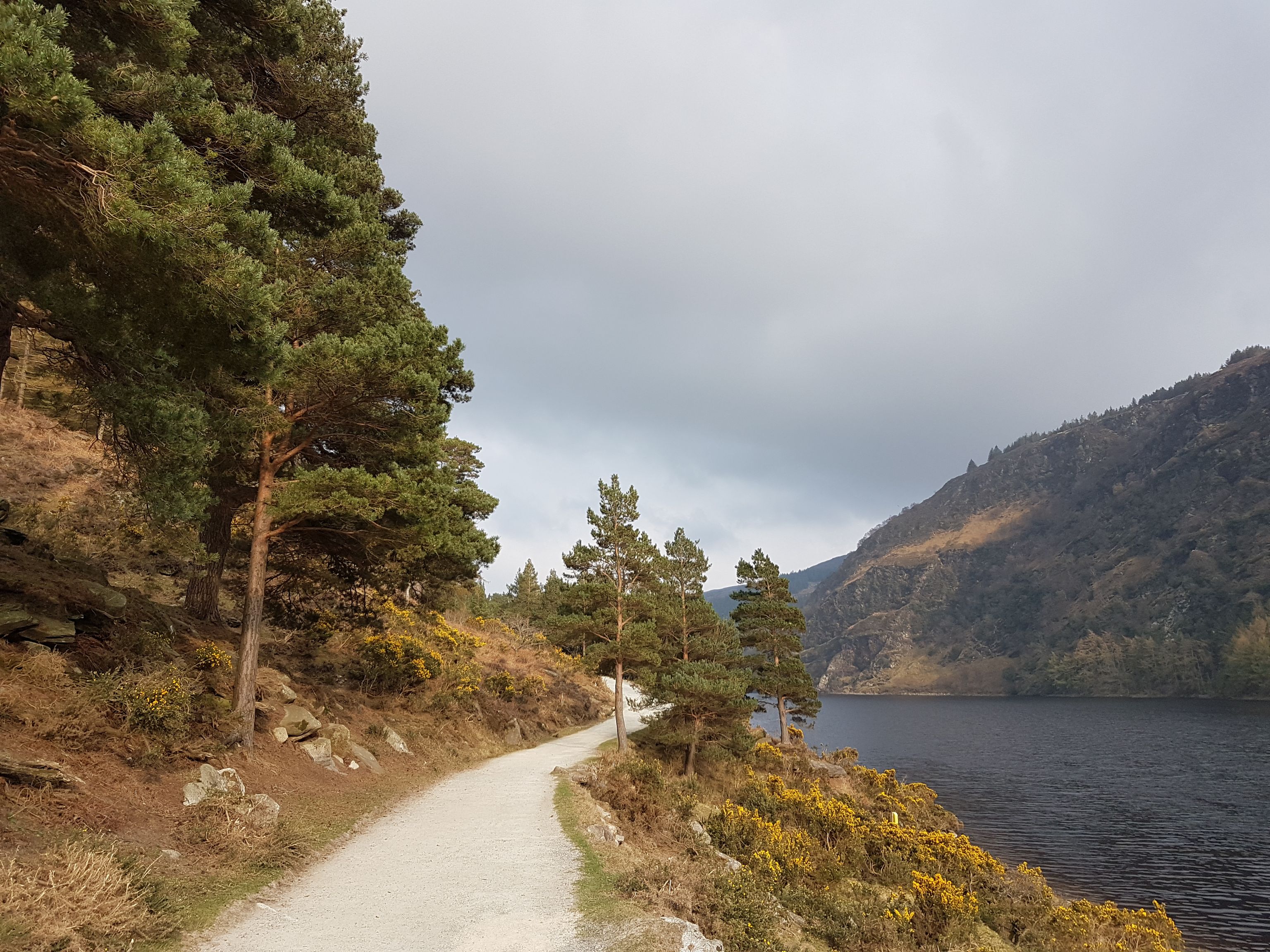
Glendalough Upper and Lower Lake Circular
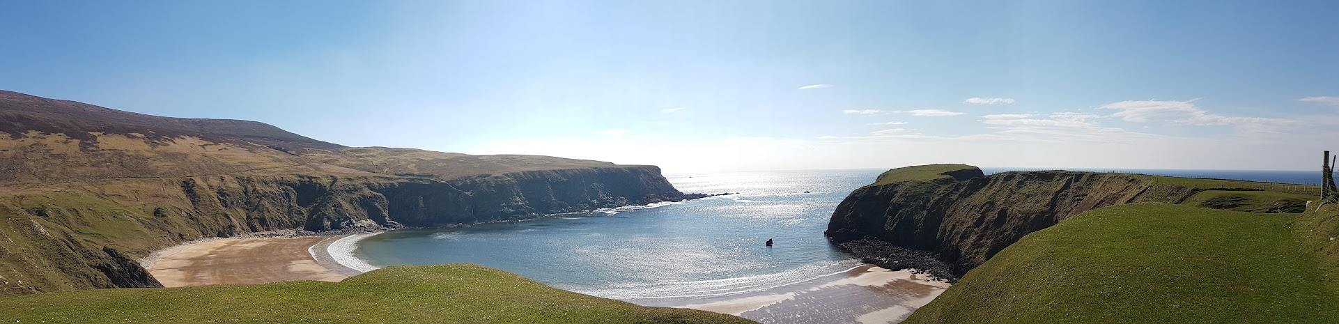
Glendalough is the English translation of the Irish word 'Gleann Dá Loch,' which means "Valley of Two Lakes." This place is a picture-perfect Irish setting. The adventurers feel as if you stumbled into an ancient fairy tale when you arrive. The glacier valley is home to the Glendalough monastery, two beautiful lakes, and several spectacular hiking paths. The valley is just an hour's drive from Dublin and is one of the best day trips from Dublin. Glendalough's walkways are suitable for people of all fitness levels and dogs must be kept on the leash at all times. Glendalough Upper and Lower Lakes are fished on a seasonal basis. From 15th March to 30th September, fishing is authorised using only artificial lures. The Park's waters are extremely deficient in nutrients, and the average trout size is only 15-18 cm. All fish less than 20.5cm (8 inches) in length must be returned undamaged.
- Route type: Loop
- Elevation gain: 345m
- Length: 8.5km
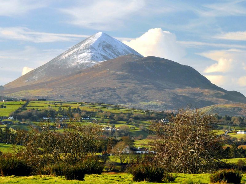
Croagh Patrick
Croagh Patrick is one of Ireland’s most stunning mountain climbs with its unique conical shape towering above the edge of the Atlantic Ocean on the rugged west coast. On a clear day, it offers panoramic views of the hundreds of tiny, green drumlin islands in Clew Bay, the Wild Atlantic Way, the gorgeous tourist town of Westport and surrounding mountain ranges. Croagh nicknamed 'the Reek', is a mountain with a height of 764 m (2,507 ft) and an important site of pilgrimage in County Mayo, Ireland. The mountain has a pyramid-shaped peak and overlooks Clew Bay, rising above the village of Murrisk, several miles from Westport. It has long been seen as a holy mountain. It was the focus of a prehistoric ritual landscape, and later became associated with Saint Patrick, who is said to have spent forty days fasting on the summit. There has been a church on the summit since the 5th century; the current church dates to the early 20th century. Croagh Patrick is climbed by thousands of pilgrims every year on Reek Sunday, the last Sunday in July, a custom which goes back to at least the Middle Ages.
- Route type: Out and Back
- Elevation gain: 749m
- Length: 7.1km
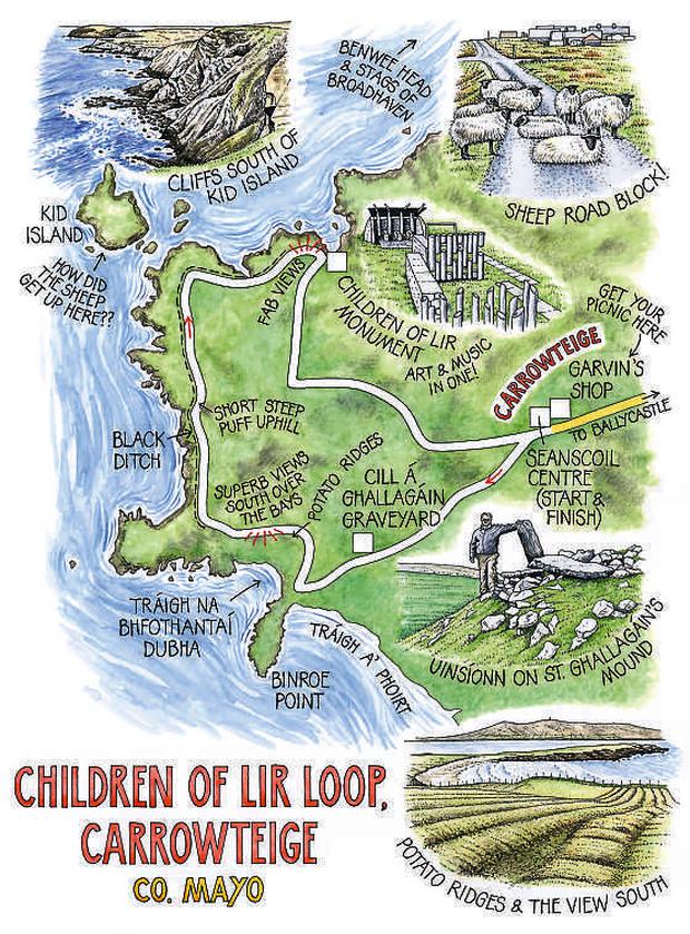
Carrowteige-Children of Lir Loop
The north coast of Mayo is one of Ireland’s best kept secrets with many of its majestic cliffs, rugged headlands, rocky coves and jagged stacks apparent only to those who leave the main thoroughfares to discover them. The Dun Chaocháin area is one of great physical beauty and has retained many of its traditions and culture - the Irish language is still the vernacular.
The Dun Chaochain cliffs have featured in various walking guidebooks including Lonely Planet - Benwee Head at 255m is the crowning glory. The Stags of Broadhaven (a group of four precipitous rocky islets rising to almost 100m) are located about 2km north of Benwee Head and are of ornithological importance. The key feature of this loop is the Children of Lir sculpture - one of a series from the Spirit of Place Sculpture Trail which centres on culturally-distinct, historic, unspoiled and isolated regions around the world. The legend of The Children of Lir tells the tale of children who were turned into swans and condemned to wander the countryside for 900 years,
300 of these were spent on the north Mayo Island, Inishglora. The sculpture has significance to this area from where thousands of people have emigrated in the past to all parts of the world – bringing with them a strong spirit of place – but never to return.
Inishbofin has 3 Looped Walks, all with stunning views of the Islands beautiful scenery.
The Looped Walks feature on the:
Ascent: 80m Distance: 8km
Estimated Time: 2hrs – 2.5hrs
Grade: Moderate
Ascent: 80m
Distance: 8km
Estimated time: 2hrs – 2.5hrs
Grade: Moderate
Ascent: 90m / 100m
Distance: 5km
Estimated time: 1.5hrs – 2hrs
Grade: Moderate
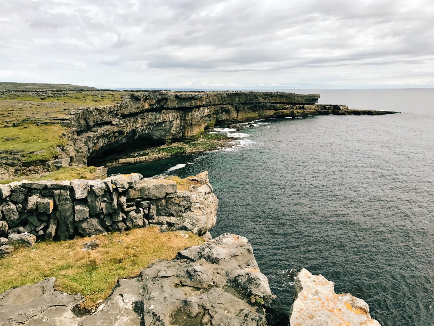
Dún Aonghasa – Inis Mor Island
Located on the 300ft cliff side or south side of Inismór, It is a semi circular stone fort over looking the Atlantic with daunting and dramatic views that stretch the length of the Island. Dun Aonghasa is deemed to be one of the best examples of its kind in Europe. Archaeologists, scholars and tourists come here from all over the world and it is likely to be given the official status of a world heritage site in the near future. Most people cycle to Dun Aonghasa from the pier and this cycle to Dun Aonghasa has become an attraction in itself due to the electic mix of attractions along the way. A 14 acre site the fort consists of three terraced walls surrounding an inner enclosure containing a platform on the edge of a three hundred foot high cliff. The views from it are breathtakingly spectacular. Excavations carried out in the 1990s indicated that people had been living at the hill top from c.1500 BC with the first walls and dwelling houses being erected c. 1100 BC. A remarkable network of defensive stones known as a Chevaux de Frise( c.700bc) surrounds the whole structure.