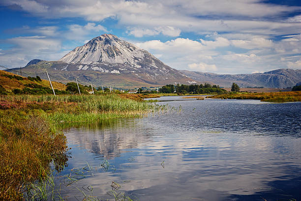
Slieve Donard

Slieve Donard is the highest peak in Northern Ireland and is part of the Mourne Mountains, a mountain range in the Southeast of Northern Ireland. Slieve Donard is only 850 meters (2,790 ft.) high, but for climbing the peak you need to climb every single vertical meter, since the ascent starts literally at sea level: at Newcastle Beach. Climbing Slieve Donard is rather easy, a well-marked trail leads all the way to the summit from the starting point in Newcastle. The route is graded T2 with a few passages of T3. The trail leads through dense forests and along many small streams. About halfway up, the dense forest makes place for the typical Irish Highlands: wet, grassy slopes with boulders covered by mosses; a sign of the wet climate. Slieve Donard is a very popular mountain for local people as well as tourists. The views from the summit are great. On clear days you can see as far as Belfast (30 miles to the North) as well as Dublin (55 miles to the south). Towards the east you have tremendous views over the Irish Sea, which is only a couple of miles away from the summit. Towards the West you can see all of the other rugged peaks of the Mourne mountains, with Slieve Commedagh (767 m. /2,516 ft.), the second highest peak in Northern Ireland, dominating the view. Slieve Donard has three subsidiary peaks on the seaward side: Millstone Mountain, Thomas's Mountain and Crossone. Slieve Donard is mostly climbed from the North (from Newcastle). Another route starts in the east at Bloody Bridge, where the bloody bridge river enters the Irish Sea. This route follows the river for a large part of the route. At the ‘’Bog of Donard’’, the saddle between Slieve Donard and Rocky Mountain, the route follows the Mourne Wall, a large stone wall built in the early 20th century, to the summit. On the summit you will find the remains of a prehistoric cairn. The Cairn measures 36 metres from north to south, 43m from east to west, and is 1m high. It appears to have been a Neolithic passage tomb, dating to a stunning 3000B.C. It is the highest known passage tomb in Britain and Ireland.

The Glen River Route

The most common route to the summit of Slieve Donard starts at Newcastle. It is named the Glen river path, because it follows the river up the mountain. You keep heading up the valley trough the dense forest. At about 350 meters above sea level the forest abruptly stops and the landscape immediately changes into the typical Irish Highlands. Without the cover of the trees, you are exposed to the elements: Strong winds and/or heavy rain are very common here. Keep heading up the mountain along the Glen River. Eventually you will reach the saddle between Slieve Commedagh and Slieve Donard. At this point you have reached the famous Mourne Wall. Follow the wall towards the east up to the summit of Slieve Donard.

The Bloody Bridge River Route

The bloody bridge parking lot is the starting point for this route. Head towards the west. The trail follows the bloody bridge river up the eastern slopes of Slieve Donard. Keep heading west until you reach Crannoge, a very small village consisting of a couple of houses only. After passing Crannoge, you will soon arrive at the ‘’Bog of Donard’’, the saddle between Slieve Donard and Rocky Mountain. From this point, the route follows the Mourne Wall, a large stone wall built in the early 20th century, to the summit.
Slieve Donard Height: 850m
Duration: 9.2km return/4-5 hours
Good for: Less experienced hikers who want a shorter walk but still be rewarded with great views

Sliabh Liag Pilgrims Path - Cosán an Oilithrigh

Slieve League is a mountain range that falls off steeply into the Atlantic Ocean, resulting in some of the highest and most beautiful sea-cliffs in Europe. The Cliffs of Moher get a lot of attention but few know that Slieve League towers a staggering 609m at its peak – nearly three times the height of its southern counterpart. The best part? Slieve league is free for the public to access. Slieve League offers breathtaking views for all types of visitors,whether arriving by car, or those willing to take the scenic hiking route. Details of directions, parking spots (plus some local tips) and hiking routes can be found below. A captivating linear hike to one of the highest sea cliffs in Europe, Sliabh Liag, this 4km trail showcases County Donegal’s renowned seascapes in all their glory. Taking 90 minutes to complete, follow in the footsteps of ancient pilgrims to McBric's Church and Well and onward to the plateau and cliff edges of Sliabh Liag in South West Donegal. Cosán an Oilithrigh or Pilgrims’ Path at Sliabh Liag is a stunning linear 4km (each way) access route on to the plateau of these famed sea cliffs. The trail follows the ancient path up a U-shaped valley nestled between Leargadachtan Mountain and the sea cliffs at Shanbally, overlooking the small fishing village of Teelin. Moderate in grade, the terrain is a mix of green road, track and rougher paths. There are a few short climbs to the plateaus, the aggregate ascent over the whole scenic route is 425m. Expect views over multiple counties, an idyllic waterfall and some Atlantic Ocean vistas too. In the nearby villages of Teelin and Carrick, you’ll find friendly welcomes and steaming pots of tea.
Trail details
Type: Linear trail
Grade: Moderate trail
Length: 4km
Estimated time: 1 hour 30 minutes

Mount Errigal & Glenveagh National Park

The tallest and steepest of Donegal’s Seven Sisters range, Errigal soars up to an impressive 2,464 ft and can be seen for miles around. Errigal(Irish: An Earagail) is a 751-metre (2,464 ft) mountain near Gweedore in County Donegal, Ireland. It is the tallest peak of the Derryveagh Mountains and the tallest peak in County Donegal. Errigal is also the most southern and the highest of the mountain chain called the "Seven Sisters" by locals. The Seven Sisters are Muckish, Crocknalaragagh, Aghla Beg, Ardloughnabrackbaddy, Aghla More, and Mackoght. Explore the low boglands, vibrant with colourful heather and spritely gorse bushes before beginning your climb to the top. Make your way to the top along loosely packed trails with some optional fun scrambling sections. Summit Errigal and walk One Man's Pass, a narrow passage to a nearby peak to experience the full magic of the mountain. The 4km long hike with an elevation gain of 500m takes just over 2 hours to complete and makes for a great day out for regular hikers.

Mount Errigal

Carrauntoohil

Carrauntoohil or Carrauntoohill is the highest mountain on the island of Ireland at 1,038.6 metres (3,407 feet 6 inches). It is on the Iveragh Peninsula in the Reeks District in County Kerry, close to the centre of Ireland's highest mountain range, MacGillycuddy's Reeks. Carrauntoohil is composed mainly of sandstone, whose glaciation produced distinctive features on the mountain such as the Eagle's Nest corrie and some deep gullies and sharp arêtes in its east and northeastern faces that are popular with rock and winter climbers. As Ireland's highest mountain, Carrauntoohil is popular with mountain walkers, who most commonly ascend via the Devil's Ladder route; however, Carrauntoohil is also climbed as part of longer mountain walking routes in the MacGillycuddy's Reeks range, including the 15-kilometre (9+1⁄2 mi) Coomloughra Horseshoe or the 26-kilometre (16 mi) MacGillycuddy's Reeks Ridge Walk of the entire mountain range. Carrauntoohil, and most of the range, is held in private ownership and is not part of any Irish national park; however, reasonable access is granted to the public for recreational use.

Characteristics

Height: 1,039 meters
Location: In the south west of Ireland, in County Kerry
Length of a hike to the top: 12km or 7.5 miles (via Devil’s Ladder)
Duration: 4 to 6 hours
Difficulty level: Challenging. Navigation skills and use of a map and compass are required. Inexperienced hikers are advised to hire a hiking guide or join a group hike.

Corran-Tuathail-via-OSheas
Different routes

1. Devil’s Ladder

The most popular route up to the top of Carrauntoohil is the so-called Devil’s Ladder, also known as the “Tourist Route”. But this route does includes all of the main highlights. The starting point for this route is Cronin’s Yard. From here, it goes after a river crossing through the extensive Hag’s Glen valley. The trail runs between two picturesque lakes and eventually takes you to the climb of Devil’s Ladder. The erosion of the trail can lead to falling rocks.So you should take hiking sticks with you.

2. Brother O’Shea’s Gully

The Brother O’Shea’s Gully Route initially runs parallel to Devil’s Ladder. This variant is more lonely and in parts even steeper than the popular “Tourist Route”. Bear right before crossing the river at Hag’s Glen. Instead of walking between the lakes, you climb above the water. This will take you from the first, to the second and finally to a third level. Here you are on the shores of Cummeenoughter Lake, the highest lake in Ireland. Keep to the left where the path runs along the eponymous O’Shea Gorge. Steep cliffs lurk below Beenkeeragh Ridge, so be careful. Hikers on this route should be familiar with using a map, compass or GPS device.

3. Coomloughra Horseshoe

This variant up to Carrauntoohil is the ultimate challenge. On the Coomloughra Horseshoe route you will climb various peaks and then you can boast of having climbed the three highest mountains in all of Ireland. The unmarked route runs here as a circular route along the mountain ridges that connect these peaks.
Long distance hikes around Carrauntoohil

Carrauntoohil is not only a breathtaking mountain for climbing to the summit, anyone hiking in the surrounding area will also catch enchanting views of the majestic giant. The MacGillycuddy Reeks are one of the largest mountain ranges in Ireland with 27 peaks and extend over a hundred square kilometers. This area is the ideal destination for hiking vacationers and is also home to the popular Kerry Way. At 214km (133 miles), this is the longest long-distance hiking trail in Ireland and runs at the foot of Carrauntoohil.

Mullaghmore

This trail in Burren National Park traverses the limestone pavement typical of the Burren and summits Mullaghmore Mountain with a beautiful view of the unique geology of the area. This loop climbs 140 m (460 ft), is 7.5 km (4.7 mi), will take about 3 hours, and is difficult due to the rocky and pitted nature of the landscape. Burren National Park is in northern Co. Clare. To get to the lay-by from Kilnaboy, turn onto L1112 by the ruined church and follow the road for just over 5km (3 mi) . The lot is a gravel pull out on the right by a stone wall with a sign. Walk through the gate on the right and follow the blue circle markings. Shortly you'll come to a road ("crag road")-turn right and follow this road for about 1 km and you'll see the trail cross through a pass in a stone wall on the left.

10 Other things to do in the Burren near Mullaghmore....

1 Father Ted's House right at the T-junction about a mile up, you cant miss it? you can even have tea if you phone in advance ah go on, go on, go on....
2 Lough Bunny, a curious turquoise crystal clear limestone lake, great spot for a paddle or a picnic.
3 Killnaboy strange double branched stone cross set into the gable end of the church and free shuttle bus through the summer into the Burren National Park.
4 Burren Yoga Centre relax and rejuvenate in this extra special place under the guidance of Dave Brocklebank, classes and weekend courses available throughout the year, excellent vegetarian food.
5 Kilfenora cathedral town with its ancient high crosses, famous Ceilí music tradition and band, details of local sessions, Vaughan’s pub.
6 The Burren Centre a charming locally run information centre in Kilfenora with audio visual and exhibition. Staff are extremely knowledgeable and helpful.
7 Corofin another former market town, with a good tradition of music food & hospitality, pretty fishing lake with cottages on the hill.
8 Dysert O’Dea Castle and archaeology centre with guided trail map.
9 Clare Heritage & Genealogical Centre an interesting resource for anyone trying to trace their Clare ancestors.
10 Caherconnell the only excavated stone fort in the Burren, gift shop and restaurant and sheepdog demonstrations, check the website for times.

The Burren

Cosán na Naomh (The Saint's Road)

One of Ireland’s most captivating pilgrim paths, this 17.7km trail is hugged by the renowned County Kerry coastline on one side and its rugged mountain landscape on the other. An historic trail, this linear pilgrim path takes 5.5 hours to complete and showcases breathtaking vistas of the Dingle Peninsula. Stretching from Ventry Strand to the foot of Mount Brandon, one of Ireland’s highest mountains, the route’s aggregate ascent is 400m. From the beach it winds gently upward along a local road that curves around and treats walkers to a backward look over Ventry Harbour and the ancient monastic island, Skellig Michael. Cosán na Naomh presents only one patch of steep terrain, leading from the summit of Reenconnell Hill - the path’s highest point at 274m. Along the way you’ll pass ancient remnants of the area’s ecclesiastical heritage from fascinating cross-inscribed stones to church ruins and beehive huts. Near constant spectacular seascapes and heathery mountain scenery make this moderate trail a real gem.

Trail details

Type: Linear trail
Grade: Moderate trail
Length: 17.7km
Estimated time: 5 hours 30 minutes

Ancient Pilgrims

We hope that you enjoyed our website. If you would like to recive more information about hiking in Ireland please send us your Name and Email and we will contact you.
Email:
We'll never share your email with anyone else.
Name: